Digital surface model
You can use a Digital Surface Model (DSM) to precisely adjust the characteristics of your 3D designs.
Since DSM sources are based on LiDAR data or machine learning methods for reconstruction from aerial images, they typically allow height adjustments with less than 10 cm error and angle adjustments with less than 0.2 degrees error.
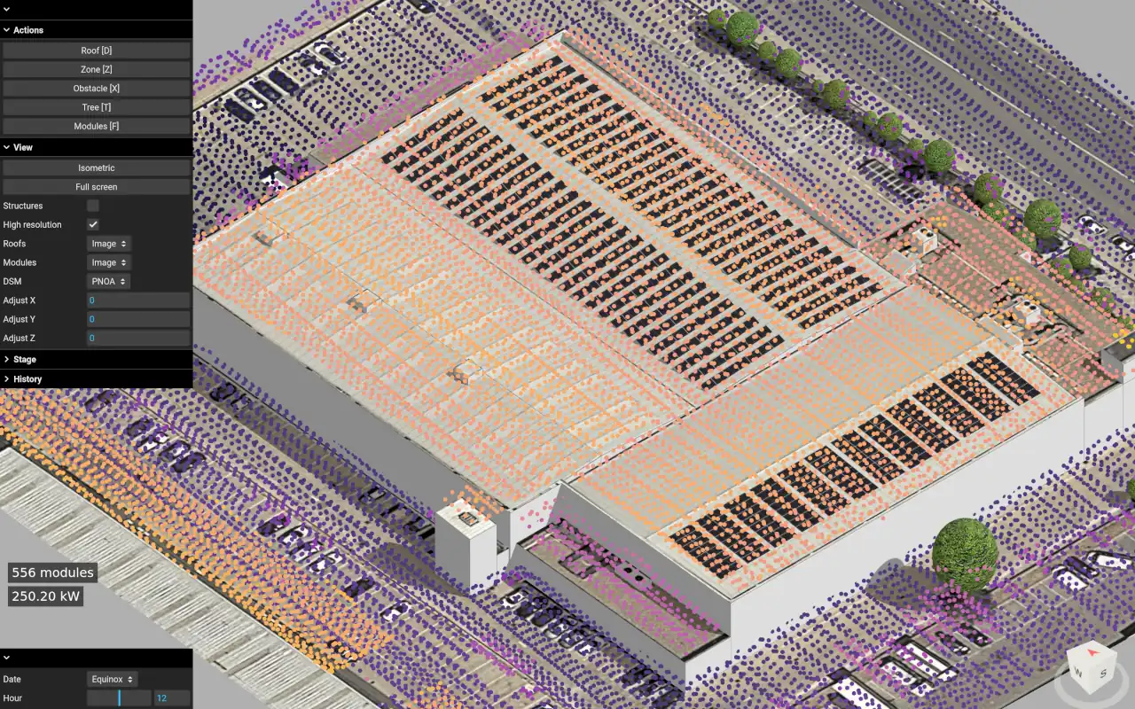
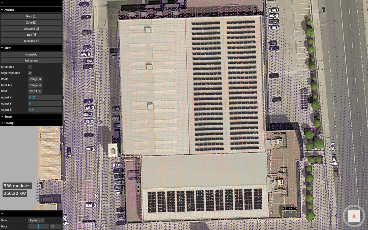
This feature depends on the availability of DSM data for each specific location. If your current project has DSM data available, you will see a drop-down selector under the “View” section (in the top-left menu of the Editor):

Visualization
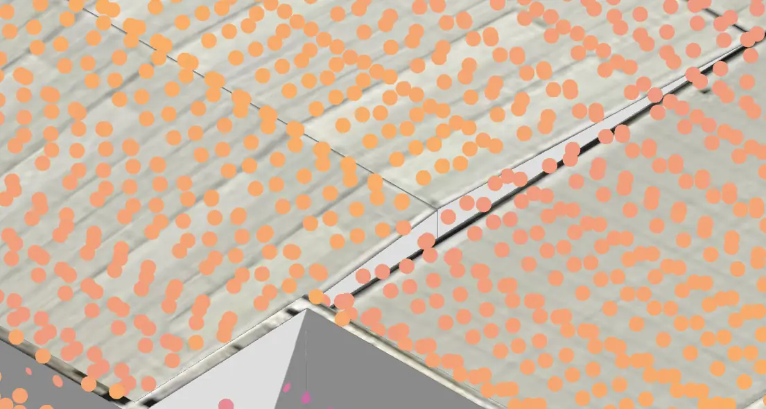
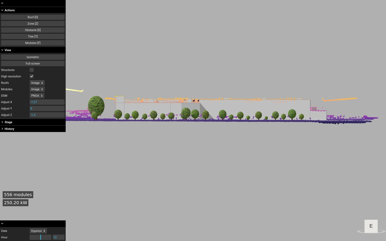
The drop-down selector shows the list of DSM sources available for your project. After selecting one of them, you will be able to see the DSM point cloud, representing the position of roofs, obstacles, trees, and the ground in 3D space:
Automatic fit
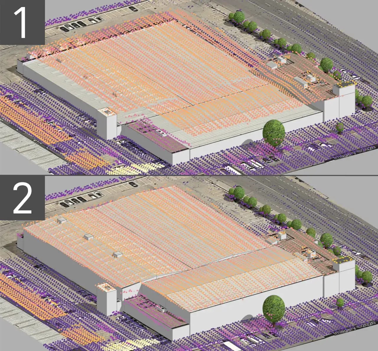
Once you draw the roof perimeters and load the point cloud, you can use the “Automatic fit” button:
This will automatically align the point cloud with the aerial image and adjust the height, tilt, and orientation of the roofs:
Manual fit
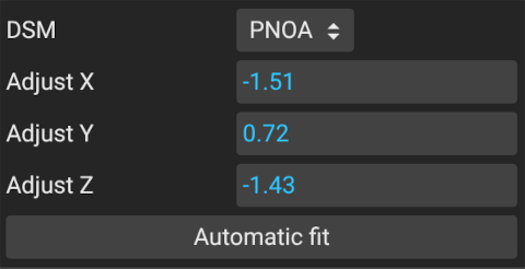
Since the DSM point cloud and the aerial image come from different sources, they may have some displacement. To align them, you can use the X, Y, and Z adjustment controls (X and Y for horizontal alignment with the aerial image, and Z for vertical alignment with the floor reference):
Once the DSM is aligned, you can draw or select any object in your design and adjust its characteristics to better match the DSM reference.
The best fit occurs when all DSM points intersect with the objects:
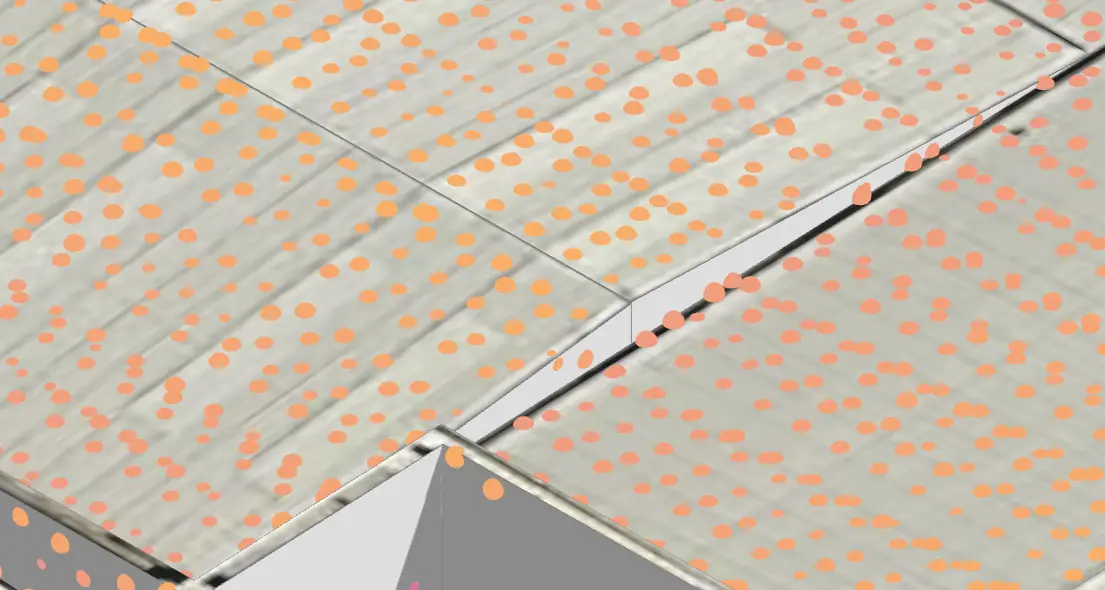
Avoid having too many points covered by the object:
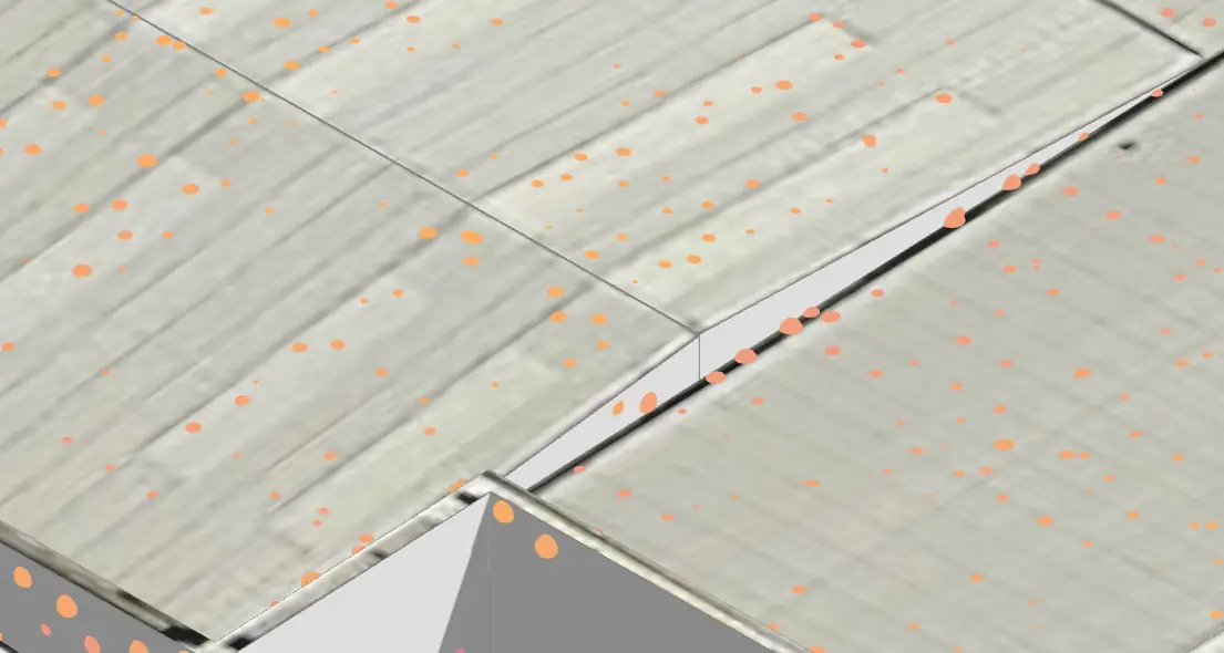
Or too many points without any intersection with the object: