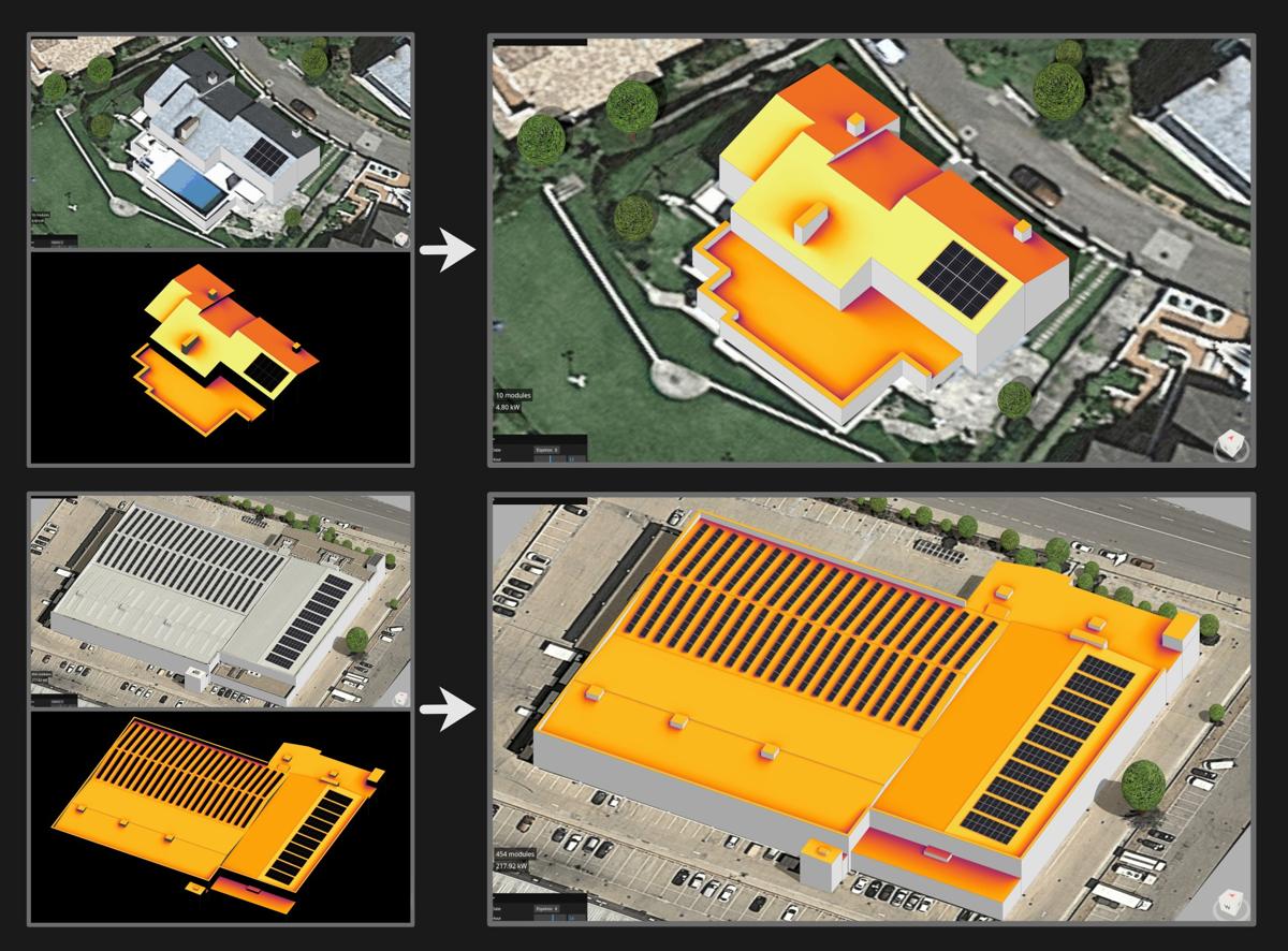
Insolation maps
Insolation maps are used to visualize, understand, and explain the impact of local shadows caused by obstacles such as trees, walls, chimneys, tilted modules, etc. Do you know how they work and how they are calculated?
For a specific point in a design, you can calculate the annual insolation by summing up the insolation for each hour of the year, taking into account the inclination and orientation of the surface at that point.
However, calculating the complete insolation in a 3D scene becomes more complicated because you need to repeat this calculation for every possible point within the design. In other words, literally millions of points, each with a different position, inclination, orientation, and a different partial shadow affection due to its nearby environment.
This requires billions of operations, but once done, you can generate a complete map with a color gradient that shows the received insolation throughout the year for each point, where warmer colors represent higher insolation and cooler colors represent lower insolation.
Of course, these colors are not just any colors; they form a perceptually uniform gradient with monotonically increasing luminance, which allows for an accurate representation of the numerical value of accumulated insolation over the entire year.
Despite the complexity of these calculations, we believe that the result is worthwhile and that these maps can be very helpful in making decisions and better explaining the results. 🚀